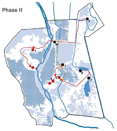
Evacuation and refuge strategy
Based on the findings from previous phases of this study, we developed a comprehensive and integrated evacuation and refuge strategy, which served as the framework for the pilot plans. The evacuation and refuge strategy includes the on-site and off-site refuges, a network of evacuation routes, and potential off-site refuges outside the PRODUIR area. The plan has three distinctive phases that respond to the severity of the flood.
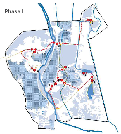
Phase I of the plan focuses on evacuation to on-site locations. During this phase, all ten selected sites can work as an on-site refuge. Evacuation starts with green routes that connect groups of houses to the orange routes. As much as possible, they follow existing paths along canals or main roads, and, preferably, are part of people’s daily life. Depending on the area, they can be elevated paths (embankments), or boardwalks on stilts. The orange routes connect to red routes (main routes). Red routes connect the different refuge sites and off-site locations.
Phase II of the plan focuses on evacuation to off-site locations within the PRODUIR area. Some selected sites double as both on-site and also off-site refuge for citizens of different fokontany.
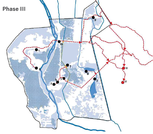
Finally Phase III covers the evacuation to off-site locations outside the PRODUIR area. This phase is only necessary if the flood is so severe, that it is expected that people will have to be relocated for several weeks. Off-site locations for Phase III are outside the study area, however, we suggest potential sites based on their capacity to harbor people in a large open area, connectivity and elevation. Potential locations for off-site refuge during Phase III are the Ecole Normale (Site 11), the botanical garden (Site 12) and the University of Antananarivo (Site 13).