How to select NbS and complementary measures
We followed an approach that focused on sites that are representative, upscalable, and multipurpose. The aim was to develop a project-wide approach, to guide stakeholders at different scales in the implementation and upscaling of NbS and complementary measures for flood risk reduction and disaster evacuation. More specifically, we recognize that certain combinations of measures are more suitable for certain locations, so we analyzed the characteristics of the area, and identified eight urban typologies. The ten selected sites (interactive map) are representative of the different typologies, so we developed a disaster evacuation plan, using the ten sites as refuges, supported by a network of evacuation routes (see these figures). We envision three different phases of the disaster evacuation plan, according to the severity of the flood.
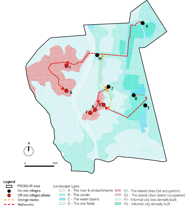
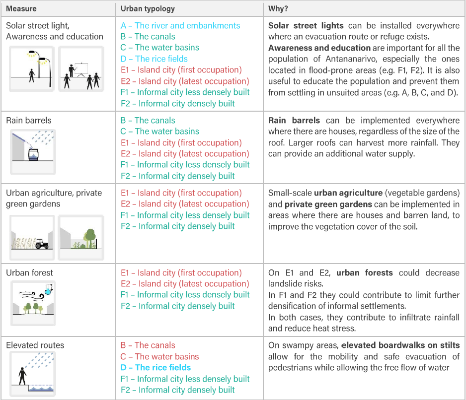
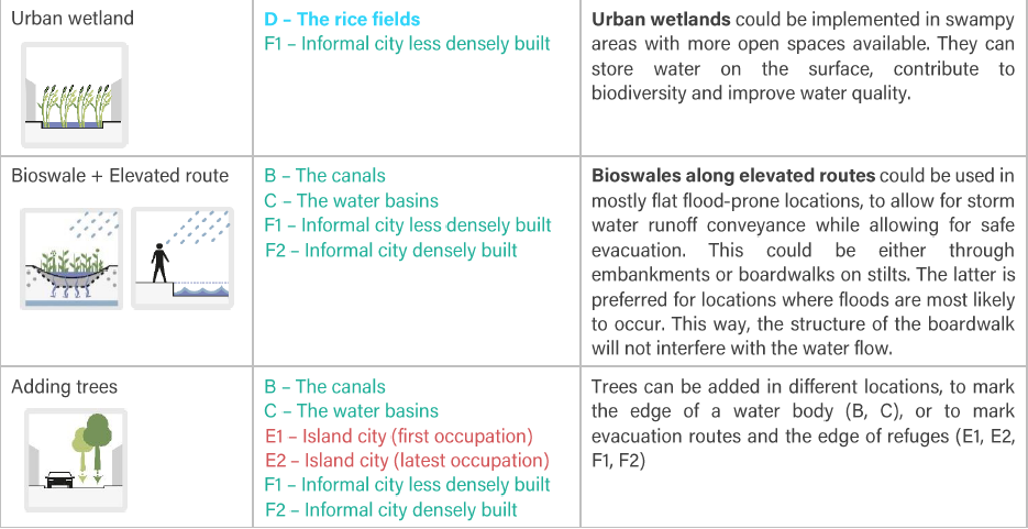
Each site, according to its characteristics, can serve a specific function as part of the plan, whether is an on-site refuge, or an off-site. Likewise, certain measures are more suitable for certain sites (see the figure below), depending on their specific characteristics. Since the ten sites are representative of the different urban typologies, based on the findings from this process, we developed a matrix (please view below) summarizing the recommended types of measures per typology. We understand that within a certain urban typology, there are many different areas, with specific characteristics. However, the matrix serves as a first guide or filter for the selection of measures.
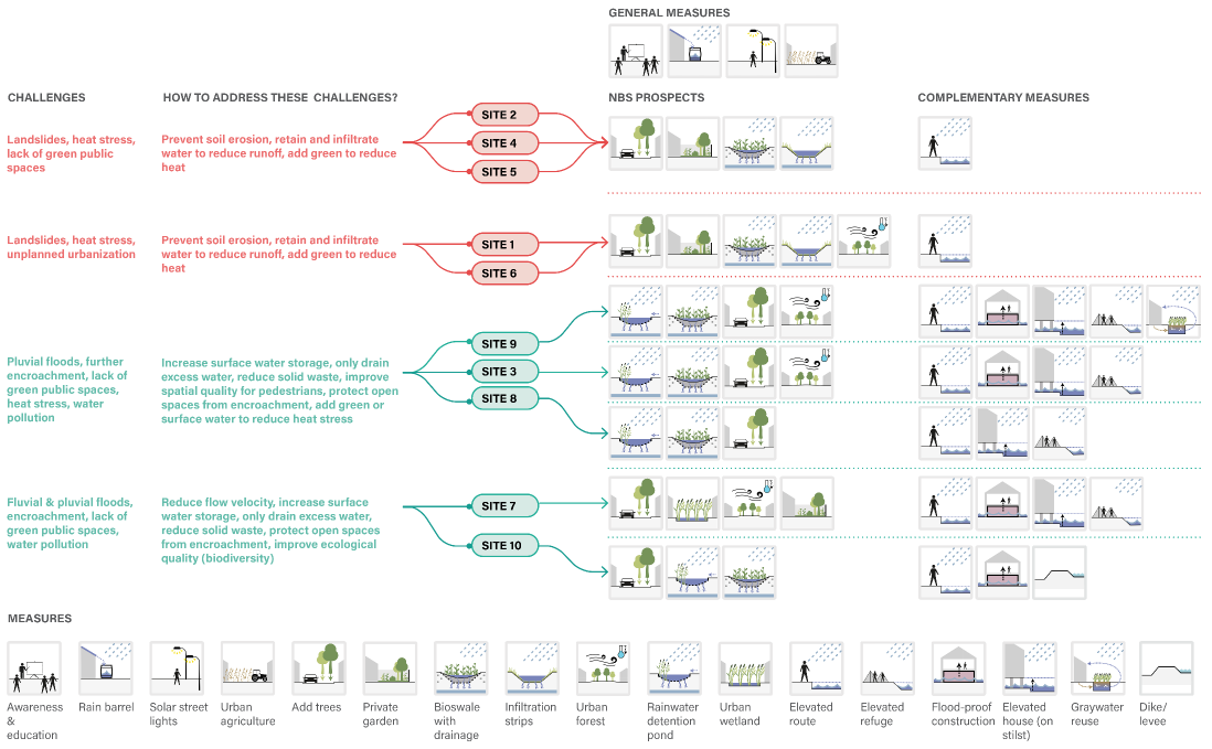

After this study, we suggest conducting further detailed and site-specific studies, such as the exact groundwater level, detailed elevation data, soil composition and level of commitment of relevant stakeholders for a specific site. According to the results of those studies, the measures could be refined, and tested, and finally upscaled, building towards an approach for the improvement of disaster evacuation and the reduction of flood risks for the PRODUIR area.